
How to Group Ottawa Attractions by Area
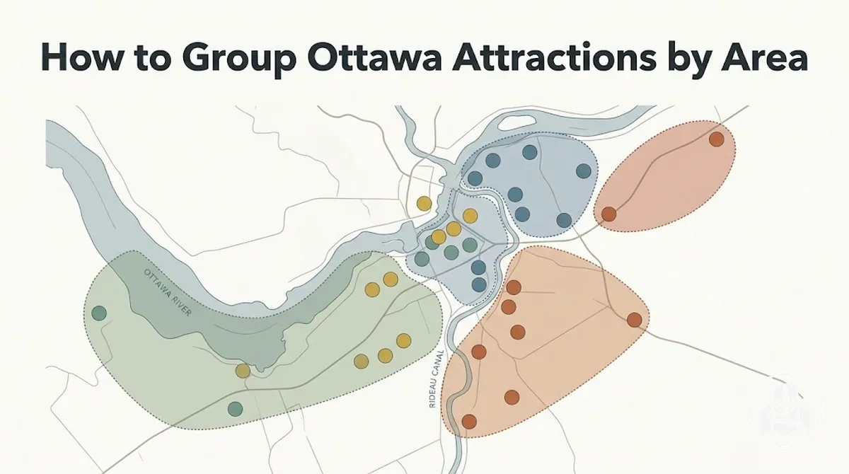
Group Ottawa attractions by practical walking proximity: start with a geographic anchor, add nearby sights, and keep them in the same cluster only when walking effort, route continuity, access conditions and available time support a coherent visit. Neighbourhood names and map distance are orientation cues, not fixed sightseeing boundaries; split attractions when detours, barriers, disproportionate effort or backtracking make the transfer impractical.
Ottawa sightseeing-area decision guide
Use the same sequence for any group of Ottawa attractions. It turns map closeness into a practical walking decision without inventing a universal distance threshold.
-
Choose an anchorStart with one clearly located attraction and tentatively add nearby sights.
-
Test the walking relationshipCheck proximity, walking effort, route continuity, access friction and the time available.
-
Keep or split the clusterKeep sights together when the transfer remains coherent; split them when detours, barriers or disproportionate effort break the flow.
-
Order the accepted areasFrom the actual start point, choose a direction that reduces repeated crossings, then adjust for time and access constraints.
Combine when
- the pedestrian connection is direct and continuous;
- the extra walking effort is manageable for the visitor;
- the transfer fits the sightseeing time available; and
- combining the stops supports a coherent movement pattern.
Keep separate when
- a detour, difficult crossing or access barrier disrupts the connection;
- the transfer requires disproportionate walking effort;
- the time cost makes the combined cluster impractical; or
- combining the areas creates avoidable backtracking or a separate transport decision.
Key boundary: a neighbourhood name can help with orientation, but the sightseeing cluster is defined by the practical walking relationship between attractions.
This page focuses on cluster boundaries and area order for efficient short-stay planning, not a timed itinerary: first decide which attractions function as nearby stops, then sequence the accepted areas. Detailed stop order, accommodation and transport choices are separate planning tasks.
Table of Contents
Use Location and Walking Distance to Define Sightseeing Areas
Ottawa attractions belong in the same practical sightseeing area when their location and realistic walking relationship support one coherent cluster.
The diagram and criteria below show how proximity, walking distance and practical access translate into a same-area or separate-area decision.

- Geographic proximity: attractions positioned close together support grouping when their separation also corresponds to practical pedestrian access; a larger or awkward separation suggests keeping them in a separate area.
- Walking effort: a walking distance that is manageable for the visitor's pace and conditions supports one cluster, while disproportionate walking effort may justify separating the attractions.
- Route continuity: a direct, continuous pedestrian connection makes a shared sightseeing area more practical; substantial detours or interruptions suggest keeping the attractions separate.
- Crossing and access friction: difficult crossings, restricted access or other barriers can make apparently close attractions function as separate clusters despite their map proximity.
- Available sightseeing time: attractions can be combined when the transfer fits comfortably within the time available; when the transfer would consume too much of that time, keeping them in a separate area has the clearer planning implication.
Map proximity describes where attractions sit relative to one another, while real walking practicality reflects the effort required to move between them.
A short-looking separation can still be less practical if route continuity is poor, crossings add friction or the visitor's pace makes the transfer demanding.
For that reason, walking distance should inform the cluster decision together with practical access rather than act as a fixed cut-off.
For example, suppose two Ottawa attractions appear close together on a city map but reaching the second requires an inconvenient pedestrian detour.
Keeping them in a separate area may produce a more coherent movement pattern, whereas a direct and practical connection would support grouping them in the same sightseeing area.
Use Walking Proximity Rather Than Neighbourhood Names Alone
Neighbourhood names help orient visitors, but they do not by themselves define a practical sightseeing cluster.
Walking proximity should control the cluster decision because the practical boundary depends on whether nearby attractions have workable walking access and route continuity.
The graphic below contrasts a neighbourhood label with the walking relationships that define a usable sightseeing cluster.

A neighbourhood label can contain attractions that do not function as one convenient walking cluster, while a practical sightseeing cluster can cross a named boundary when the pedestrian connection remains straightforward.
For example, suppose two Ottawa attractions share the same area label but the usable pedestrian path between them requires a substantial detour; their shared neighbourhood name would not by itself justify grouping them together.
Conversely, nearby sights on opposite sides of a named boundary may belong in the same cluster when walking access remains continuous and practical.
Area grouping identifies which attractions function as nearby stops; it does not determine the exact order in which those stops should be visited.
Once the practical cluster is established, the separate task is to turn nearby attractions into a walking route.
Decide When Adjacent Attraction Groups Are Close Enough to Combine
Adjacent clusters should be combined only when the transfer between them remains practical for the visitor's available time, pace and movement constraints.
The diagram shows how the connection between two attraction groups can support either one larger sightseeing area or two separate clusters without relying on a fixed distance threshold.

- Combine — close connection: combining adjacent clusters may be practical when the gap between them creates little additional transfer effort and the walking connection fits naturally into the movement pattern.
- Combine — manageable time and pace: one larger group can make sense when the walking effort between clusters remains practical within the visitor's available time and expected pace.
- Keep separate — disruptive transfer: adjacent clusters should remain separate when moving between them requires enough extra walking effort or interruption to break the sightseeing flow.
- Keep separate — backtracking: separation may be clearer when combining the clusters would cause avoidable backtracking rather than support a continuous movement pattern.
The combine-or-separate decision depends on the transfer between already-formed clusters rather than proximity alone.
A nearby pair can still remain separate when the connection adds disproportionate transfer effort, while a practical connection can justify combining the clusters when it fits the available time and movement pattern.
No universal distance cut-off applies to this planning decision because visitor pace, transfer conditions and available time change the practical result.
For example, two adjacent clusters may work better separately if moving between them interrupts the sightseeing flow or no longer suits the visitor's remaining time and pace.
If that transfer starts to require a transport decision rather than a straightforward connection between clusters, the next planning task is to match attraction groups to transport.
Group Nearby Ottawa Attractions into Practical Area Clusters
Build each practical area cluster around a clear geographic anchor, then add nearby Ottawa attractions that appear to belong with it.
The image summarises the sequence from anchor attraction to nearby attractions, proximity test and the final keep-or-split decision.

The four steps below turn individual attractions into an area grouping that can be checked consistently without creating a full itinerary.
Each step performs one job before the cluster is accepted or divided.
- Choose a geographic anchor. Start with one clearly located attraction that can serve as the reference point for the cluster.
- Add nearby attractions. Place nearby sights around the anchor when their location suggests they could function as part of the same practical area.
- Run the proximity test. Test the proposed cluster for walking practicality using the previously established criteria for practical movement between attractions.
- Keep or split the cluster. Keep the attractions together when the proximity test supports one practical area cluster; split them when the connection makes the grouping impractical. This decision determines whether the area grouping remains one cluster or becomes separate clusters.
A completed practical cluster should have one understandable geographic anchor, a coherent set of nearby attractions and a walking relationship that passes the proximity test under the relevant conditions.
Once those elements are clear, worked Ottawa examples can demonstrate the same grouping method without changing its underlying sequence.
Parliament Hill and the Downtown Core
Use Parliament Hill as the anchor to test whether nearby sights in the downtown core form one practical sightseeing cluster.
The annotated example shows how the National War Memorial, Wellington Street and Rideau Canal access relate to the anchor through their walking relationship and grouping implication.

- National War Memorial: the memorial sits at Confederation Square, east of Parliament Hill along Wellington Street, so it is a natural nearby sight to test within the same downtown cluster when the pedestrian connection suits the visitor.
- Wellington Street: the street runs directly along the Parliamentary Precinct in front of Parliament Hill, making it part of the anchor’s immediate spatial context rather than a separate destination area by default.
- Rideau Canal: the Ottawa Locks at the canal’s northern end sit below Parliament Hill, creating a direct proximity relationship that supports testing this canal access point within the same cluster when the route remains practical.
Together, these spatial relationships show how Parliament Hill can anchor a downtown core cluster without automatically absorbing every central attraction into the same group.
Practical walking access still determines whether each nearby sight remains inside the cluster boundary.
ByWard Market should therefore be treated as a separate boundary test rather than assumed to belong to the Parliament Hill cluster solely because it is part of the central sightseeing context.
ByWard Market and Nearby Attractions
Use ByWard Market as the anchor to test whether nearby attractions form one practical sightseeing cluster.
The annotated example identifies the National Gallery of Canada, Notre-Dame Cathedral Basilica, Major's Hill Park and Rideau Street as nearby places whose walking connection helps define the ByWard cluster.

- National Gallery of Canada: the Gallery is close to ByWard Market and can fit the same practical cluster when the pedestrian connection matches the visitor’s pace, time and access conditions.
- Notre-Dame Cathedral Basilica: the basilica is opposite the National Gallery on Sussex Drive near the market, so it can remain in the ByWard cluster when walking access from the anchor is continuous and practical.
- Major’s Hill Park: the park lies between the ByWard Market area and the Parliament Hill side of the central core, making it useful for testing the western edge of the ByWard cluster rather than assuming automatic membership.
- Rideau Street: the street runs along the southern edge of the ByWard Market area and can act as a boundary cue where the market cluster connects toward the broader downtown core.
These relationships keep ByWard Market dominant as the anchor without treating every nearby central attraction as automatic cluster membership.
A practical walking connection and continuous movement pattern can support keeping these nearby sights together, while locations extending toward Parliament Hill or the wider downtown core may justify a separate grouping decision.
The cluster implication therefore depends on practical proximity and route continuity rather than central location alone.
Order Sightseeing Areas to Reduce Backtracking
Order completed sightseeing areas from a chosen start point so the sequence follows a coherent movement pattern and can reduce unnecessary backtracking.
The resulting area order should respect both the clusters' relative position and any time constraints or access constraints that affect which area is practical to visit next.
- Identify the start point. Establish where the sightseeing period begins because the same set of areas can require a different first move when the starting location changes.
- Compare the relative position of the sightseeing areas. Look at how the completed clusters relate spatially so consecutive areas can follow a coherent direction rather than requiring repeated crossings.
- Choose a direction of travel. Arrange the next-area choices so the movement pattern progresses through the selected clusters with as little unnecessary retracing as practical.
- Account for time constraints and access constraints. Adjust the cluster order when available time or access conditions make an otherwise logical next area less practical under the current trip conditions.
- Verify the sequence for backtracking. Check whether the proposed order repeatedly crosses the same ground; if it does, reconsider the next-area choice while keeping the start point and constraints unchanged.
For example, the same central Ottawa sightseeing areas may follow one sequence when the visitor starts near the downtown core and another when the start point is closer to an outer cluster or the available time is shorter.
The preferred order changes with those conditions rather than following one universal arrangement.
Once the area sequence is established, converting those ordered clusters into timed stops is the separate task of learning how to build an efficient one-day route.